Sinkhole adjacent to wave wall led to identification of deep void under foundation
Publish date
05 December 2025
Case ID#
3355
Title
Sinkhole adjacent to wave wall led to identification of deep void under foundation
Nation
England
Regulator reference no.
536
Legal status
Statutory
Reservoir type
Impounding
Reservoir capacity
25,000 - 99,999m3
Year of construction
1800 - 1849
Main construction type
Earth fill embankment
Dam height
5 - 9.99 metres
Dam flood category
B
Hazard class
High-risk reservoir
Reservoir use
- Recreation or general amenity
Owner type
Public body
Date & Time of incident
30 December 2024 - 12:00
Date incident closed
02 January 2025
Observations that caused the incident to be declared
- Deformation or instability of crest (settlement, cracking, depressions)
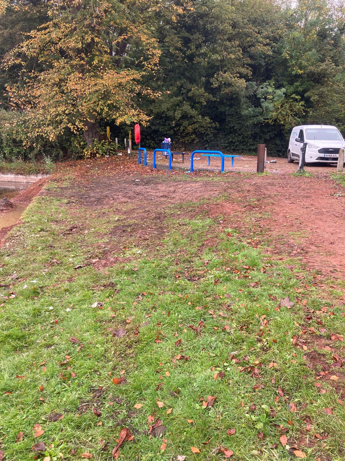
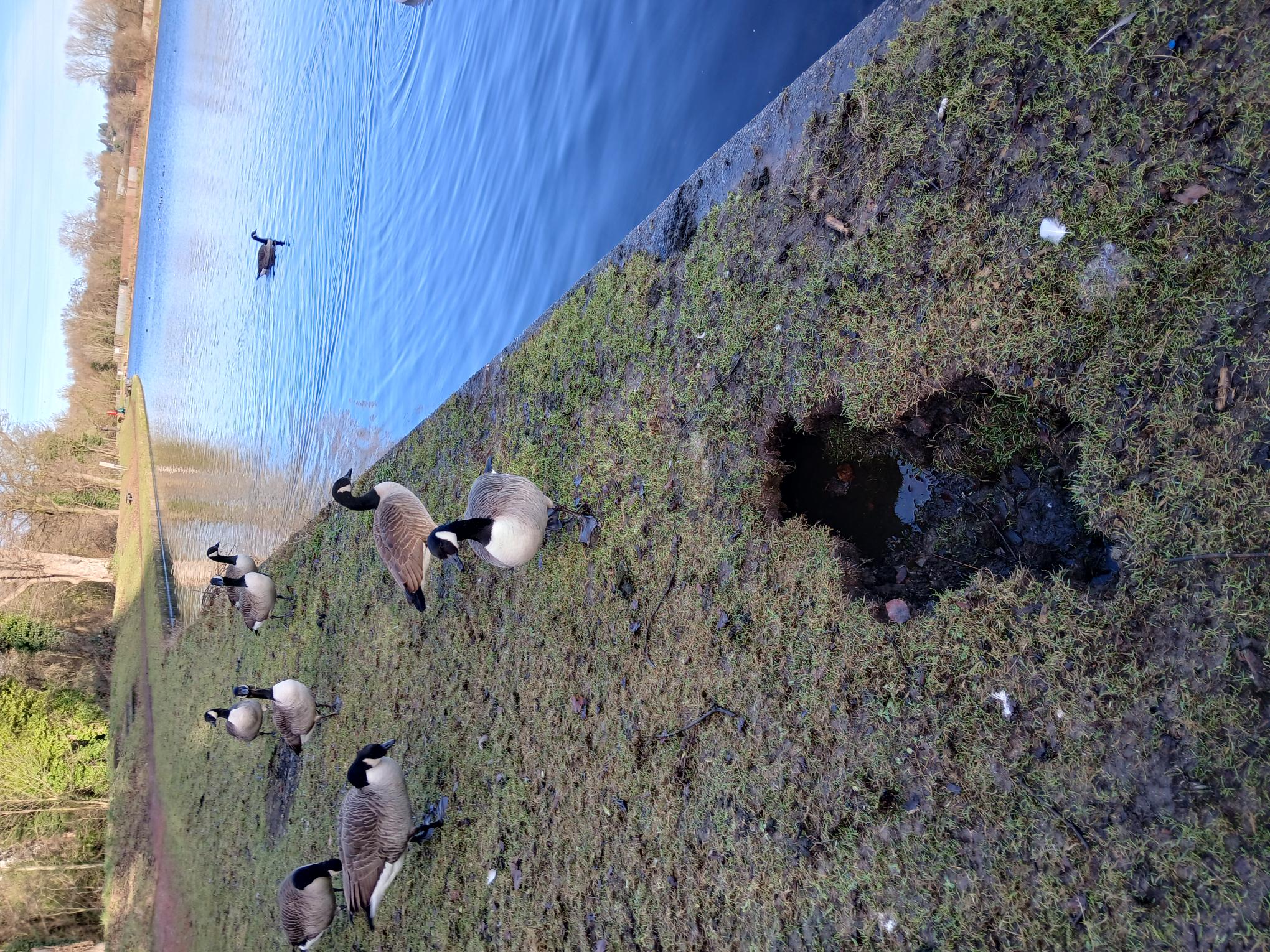
Describe the incident
Supporting photos
Sinkhole as it was found
Natural processes which initiated or contributed to the incident
- Heavy/persistent rain (no flood)
What were the main contributing factors to the incident occurring?
Dam factors
- Deterioration of materials
External factors
- None
Shortcomings
- Design shortcoming
What was the root cause of the incident?
Impacts on the reservoir
- Internal erosion (fill deterioration)
- Settlement / deformation (outside normal or expected parameters)
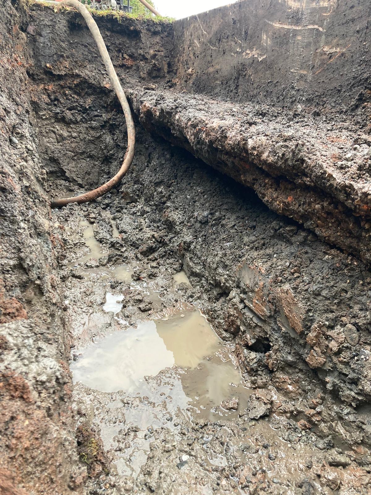
Supporting photos
Photo showing excavated section of wall foundation and the void found
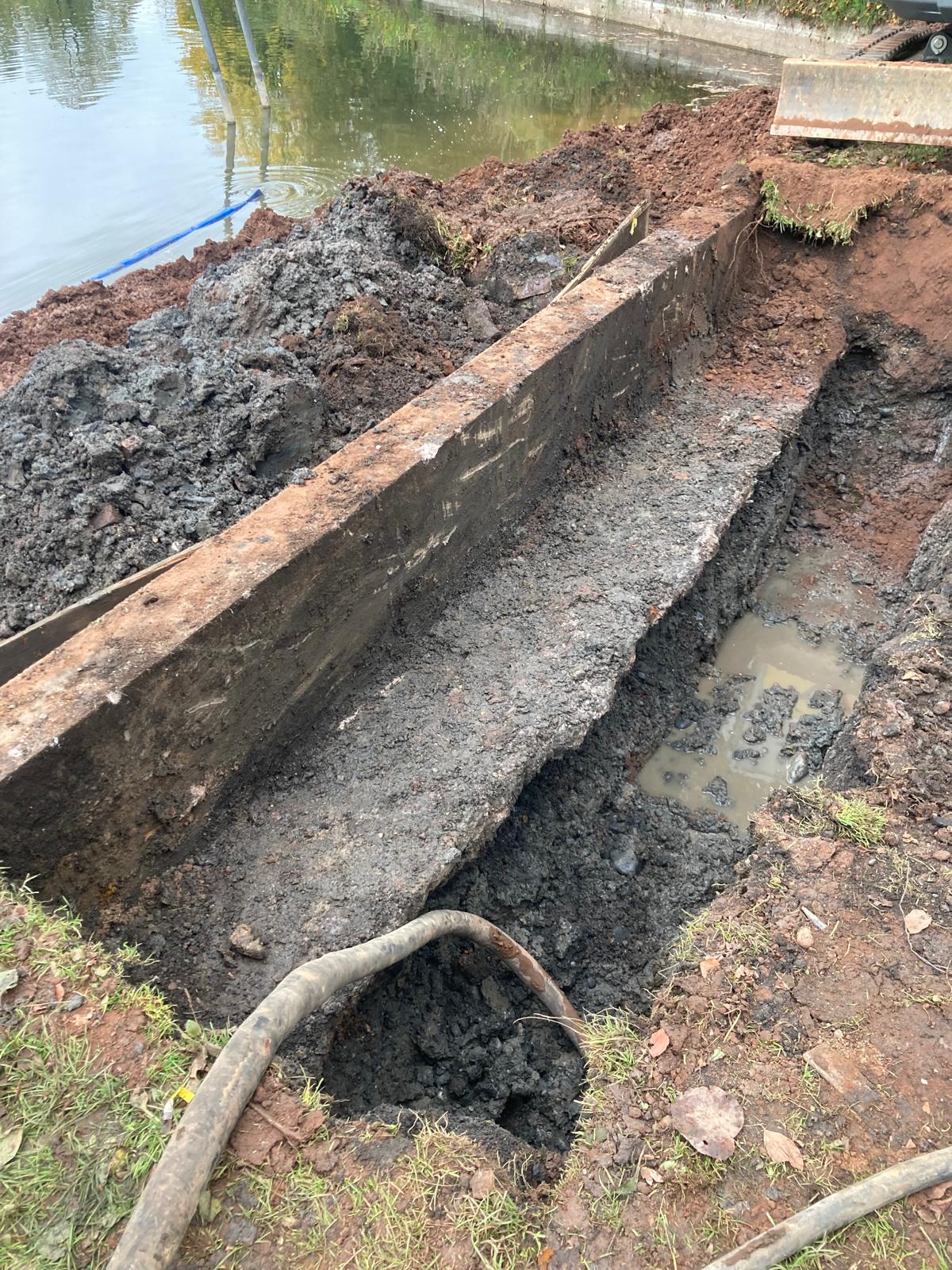
Photo showing excavated section of wall foundation and the void found
Describe any human factors which influenced the incident
Describe any instrumentation at the reservoir and how this was used in warning of the incident or providing monitoring during the incident
Was instrumentation effective leading up to and during the incident?
Not Applicable
Describe any assistance by external parties and impacts on the downstream population
Summary of studies or investigations undertaken
Supporting photos
Photo showing concrete backfill of the wall foundation to seal the void
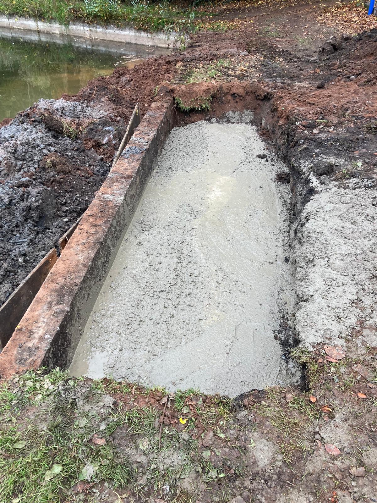
Photo showing dam embankment following repairs